| |
| Home |
| Model Builder |
| Python and VBA Programming |
| Database Operations |
| Geodatabase |
| ArcServer |
| Data Sources |
| GeoStatistics |
| Training Certificates |
![]()
Geodatabase
Managing and accessing an enterprise geodatabase
A geodatabase is a collection of geographic datasets of various types stored in a common file folder, such as a Microsoft Access database. Geodatabases contain three primary dataset types: Feature classes, Raster datasets and Tables. Often in a large organization, several people will work on the same project using the same database. It is most efficient to have one copy of the database that each person in the work group can access and edit (given the right admin privileges.) ArcSDE is a middleware software that facilitates connection to an enterprise database, thus preventing several rogue databases lurking on company computers.
Analysis Procedures
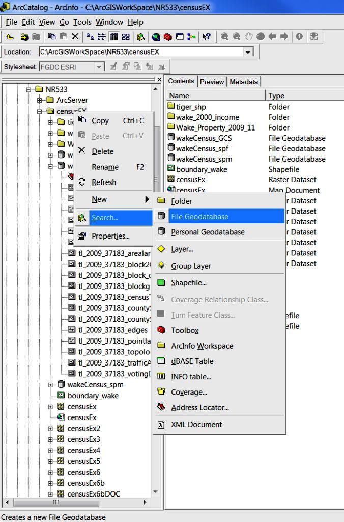
Create a personal or file geodatabase with ArcCatalog
Establish a Virtual Private Network (VPN) connection to the server at NCSU
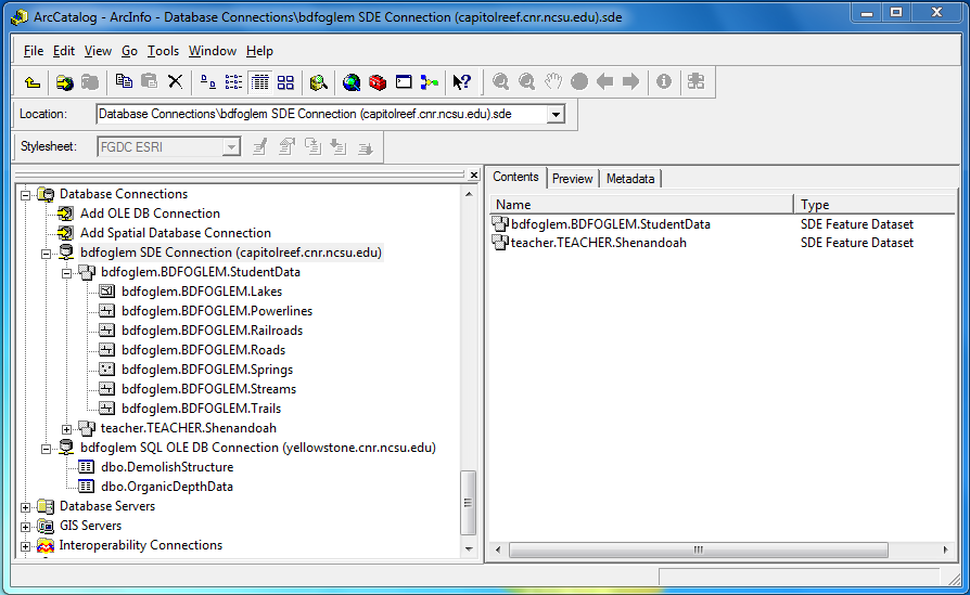
Establish a Spatial Database Connection (SDE) in ArcCatalog to access spatial data
Establish an MS SQL (OLE DB) Connection in ArcCatalog to access SQL data
An example of an Enterprise environment configuration:
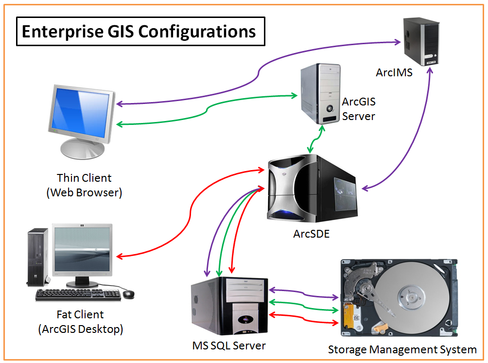
Courtesy: Bill Slocumb, GISP, Research Associate, NC State University
Creating a file geodatabase in ArcCatalog is a simple procedure. Once the database is created, it can be populated with data.
Below is a screenshot of the SDE and SQL connections established in ArcCatalog. These database connections and their associated geodatabases (feature classes and tables) were used to create the fire risk map in the ArcServer page.
When a requirement arises to create a geodatabase, it is important to decide which of the three kinds of geodatabases to create.
File Geodatabase: stores datasets in a folder of files on a computer. Each dataset is a file up to 1 TB (can be configured to store a larger dataset). This is a good default choice.
Personal Geodatabase: stores its datasets in a MS Access file on disk. The entire database is generally limited between 250 and 500 MB and is only supported on Windows.
ArcSDE Geodatabase: stores datasets in optional database management systems (DBMS) including:
Oracle
Oracle with Locator or Spatial
SQL Server
DB2
Informix
PostgreSQL
Applications
Many advancements in computing power, disk storage space, network capability and network security make ArcSDE Geodatabases a great choice for organizations who manage a large amount of spatial data.